
Trace a Colorado Street Address
Work from the address outward. First identify the county, because Colorado has no single statewide deed or property-owner index for all 64 counties. A parcel is a mapped piece of land with a county account. Its situs address is the place where the land sits; its mailing address is where tax notices go. Those two addresses may point to different cities or ZIP codes, and a mailing address does not prove who lives at the property.
The most reliable street-by-street search keeps each record's purpose clear. The assessor names the taxable owner, the map ties that account to a parcel, and the recorder preserves legal instruments. Voter and library sources can add distinct evidence about people, but no public statewide service lists everyone at every address.
- Enter the address in the county assessor or parcel map. Save the parcel number, owner name, situs, mailing address, and legal description.
- Open the parcel in a GIS viewer. Check the county and nearby parcel shapes, then follow the county assessor link to confirm the roll.
- Search the correct Clerk & Recorder by owner or legal description. Record the reception number, document type, date, and grantor.
- Use voter information only through the documented individual lookup or a lawful request to the proper county or state custodian.
- For an older household, check a local library's address-arranged directory or ask its reference staff which regional volume covers the town.
Colorado Street Search in Arapahoe County
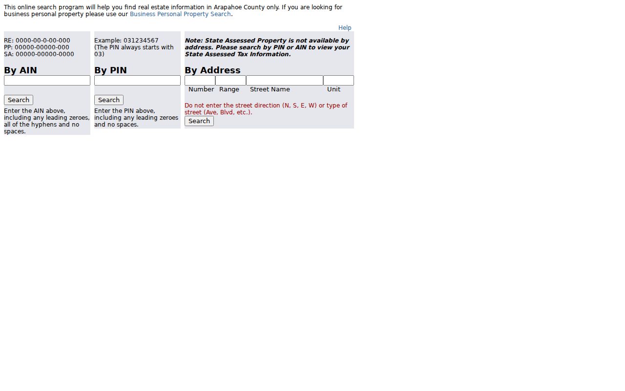
The Arapahoe County property search documents a useful number-range method for browsing parcels along one road. Its address mode has separate fields, and the instructions ask users to leave out the directional prefix and street type. Counties normalize street names in different ways, so this is an Arapahoe procedure rather than a statewide rule.
The search screen offers AIN, PIN, and address modes. The county says to retain leading zeroes and hyphens for the ID values. State-assessed property is not available through the address search and should be sought by PIN or AIN.
| Search field | Input type | Required | Documented use |
|---|---|---|---|
| AIN | Text | No | Keep leading zeroes and hyphens; enter no spaces. |
| PIN | Text | No | Keep leading zeroes; the route for state-assessed property. |
| Number | Text | No | Exact address number or lower end of a range. |
| Range | Text | No | Browse a run of numbers along one street. |
| Street Name | Text | No | Omit street direction and street type. |
| Unit | Text | No | Add a condo or apartment unit where applicable. |
| Search mode | Tabs or radio controls | No | Choose By AIN, By PIN, or By Address. |
| Help | Link or button | No | Open the portal's help information. |
For a street segment, test a range and review the returned parcels one at a time. If the target lies in another county, use that county's assessor instead of assuming Arapahoe's field rules apply.
The linked Arapahoe search tabs show the AIN, PIN, and address routes side by side. Start with the number range when the aim is to inspect one stretch of road, then confirm each account with its parcel details.
This interface is not a statewide assessor. If an address lies in Denver, Larimer, or another county, follow that county's own property search and use its local rules.
Colorado Street Parcels Show Two Addresses
The Colorado State Map Viewer gives a map-first route: find an address or place, zoom to the parcel, turn on useful boundary layers, and click the polygon. County map tools vary. The state service can support queries and map geometry, but its county-fed data may be incomplete or out of date, so confirm details with the county assessor.
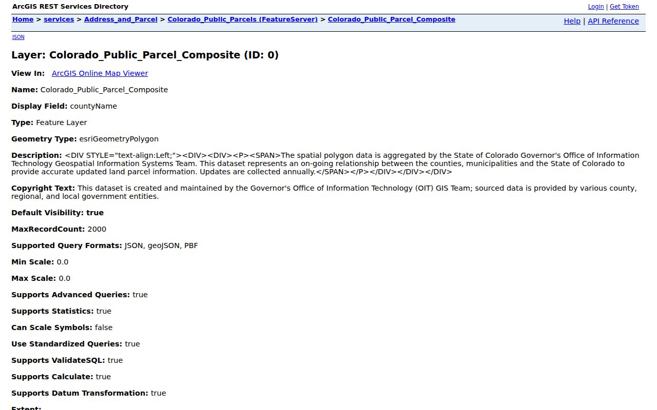
Before opening the statewide parcel layer, the Colorado parcel schema can be reviewed through its source-linked record. Its fields separate the physical site from the owner's tax-mail address. The image below shows that schema-level source; it is a field inventory, not a certified assessment or title record.
Use the map to note the parcel ID, county, situs city and ZIP, owner mailing city and ZIP, legal description, and block or lot. Then open the county assessor's own record. A map popup is a practical routing aid, not a substitute for an official parcel record.
Colorado Address Records Along One Street
A street directory search crosses more than one custodian. The assessor covers taxable property; the Clerk & Recorder holds deeds and plats; planning offices hold permits and code cases; election officials control the public voter subset. The statewide layer helps locate the parcel, while county counters, phone contacts, book searches, and public-record requests fill gaps in online coverage.
| Record kind | Office or keeper | What it can show | Where to ask |
|---|---|---|---|
| Assessor parcel | County assessor | Taxable owner, situs and mailing address, legal description, value, and property details | County portal, map or data service, counter, phone, or public data request |
| Parcel GIS | County GIS or state OIT | Parcel shape, parcel ID, nearby lots, address, ZIP, and map layers | State or county viewer, query, or API |
| Recorded deed or plat | County Clerk & Recorder | Parties, legal description, recording date and number, liens or easements | County index, image access, book search, counter, or copy request |
| Permit or code case | City or county planning office | Work, date, applicant, contractor, inspections, or case details | Permit portal, planning records office, or CORA request |
| Voter record | County clerk or Secretary of State | Limited public registration fields; protected fields are withheld | Individual Go Vote service or a documented request to the custodian |
| Historical directory | Library or archive | Named residents, owners, or businesses by address in a dated book | Digital collection, library reference desk, onsite books, or microfilm |
| Tax account | County treasurer | Tax bills, payments, delinquency, and tax-sale information | County portal, counter, phone, or public-record request |
Parcel number and legal description link assessments, deeds, plats, and permits. A street label can be less stable, especially in older Denver records. The voter row describes a lawful access route, not a public street-by-street roster.
Colorado Deed Records by Legal Description
A recorder often indexes the parties to a document instead of offering a clean address search. Start with the assessor's owner and legal description. In the county recorder index, find that owner as grantee, meaning the party who received the property. Read the deed for the grantor, the party who transferred it, and note the legal description, recording date, and reception number.
Then search the grantor as an earlier grantee and repeat backward. Search lot, block, subdivision, or an older street name if the modern address yields no match. A deed of trust, release, lien, or assignment is not the same as a transfer deed, so check document type before adding a transaction to the chain.
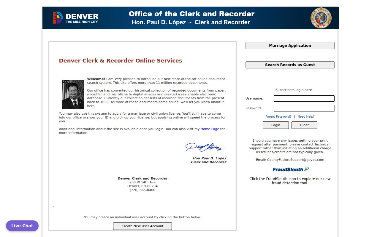
Denver's CountyFusion recorded-document index reaches from 1859 to the present, and a city audit reports more than 11 million documents. Paper records not yet digitized can be requested for retrieval and digitization. Larimer's Easy Access index covers 1971 onward; older books require an office search. Anonymous visitors see data only, free registration gives watermarked images, and clean copies cost $0.25 per page up to 8½ by 14 inches or $2 for larger or plat images. These are county examples, not statewide cutoffs.
When a portal stops, contact the recorder for a counter or book search, ask about mail or copy requests, or consult a local archive's indexes. Colorado has no statewide deed index that replaces these county routes.
Denver Street Names Changed Over Time
Denver's street system can make a correct address look absent. A citywide address overhaul began in 1887; ordinances in 1897 and 1904 changed street names and standardized the numbering system. The 1887 directory's own introduction says publication was delayed by the renumbering and street-name changes. That history is a practical warning when tracing a house, not simply a note about city planning.
For an older Denver address, compare the period street guide with the current name and number. The Denver Public Library street-name guide and historic Sanborn maps can help connect earlier labels to current blocks. Lot, block, and legal description often remain a steadier bridge than a street name. Former place names such as Montview, Colfax, Barnum, and former Arapahoe County may also appear in archival headings.
Colorado Street Indexes in Criss-Cross Books
Historical reverse or criss-cross directories give a different kind of street evidence. Denver Public Library's householder collection begins in 1924, and broader criss-cross holdings extend through 2018. An entry leads from an address to an owner, resident, or business in that book's year, not necessarily today.
Read the volume's street guide and abbreviations first. Then compare an address-arranged entry with the name-arranged directory for the same year. That can help separate a resident from an owner, spouse, or business entry. For places outside Denver, the Colorado Directories Index points to the regional book that includes a town; a smaller place may be listed under a neighboring town's heading.
Ask the library about onsite volumes, microfilm, digitized pages, or reference help when a book is not online. The broader collection details belong with the Colorado city directory collections; this street use starts from a house number.
Denver Street Permits Date Work at Addresses
Permits and code cases can add a date or project name to a property trail. Denver's E-permits process supports searches by address, project, owner, or contractor. The entry may describe proposed work or inspections, but it does not establish who lived there. Older logs are a separate source.
Denver Public Library indexes permit logs for 1889-1892 and 1900-1914, alongside assessor cards, directories, and Sanborn maps. If a portal is missing a record, ask the planning office about counter access or a CORA request. Other Colorado jurisdictions use their own systems and retention periods.
The Denver permit process describes the current address-based route. Use its result as a construction or alteration clue, then compare it with the assessor and recorded parcel history.
Colorado Voter Records Have Limits
Go Vote Colorado is an individual service for registration, ballot status, sample ballots, and updates. It is not a public browse tool for every registered voter on a street. A county clerk holds local voter records, while the Secretary of State manages statewide systems and directs requests to the right custodian.
The public voter-file subset can include a person's name, residential and mailing address, year of birth, party, vote history, and active or inactive status. Month and day of birth, ID numbers, signature, email, and other fields are confidential. A full SCORE lookup is controlled for designated election officials. Protected voters and Address Confidentiality Program participants have added privacy protections.
Use an individual lookup for a personal record, or ask the state or county custodian about lawful public-file access and redactions. An active registration is not proof of present residence; records and addresses can lag. A street directory must describe voter information as a limited public record, never a complete count of current occupants.
Colorado Parcel Fields in Street Records
The public parcel layer's sample schema shows why a record should be read field by field. It carries county and parcel identifiers alongside both the physical site and the owner's mailing address. Those fields can help move from a street number to the right county record, but they do not establish occupancy or replace a recorded instrument.
These are documented field groups visible in the statewide feature service. County updates can change the data, and the service warns that it may not be complete, accurate, or timely. Treat each field as a route to confirmation.
| Field group | Examples in the parcel record |
|---|---|
| Jurisdiction and account | County name, county FIPS, parcel ID, account |
| Site address | Situs street, situs city, situs ZIP |
| Owner and mailing address | Primary or secondary owner, mailing street, city, state, country, ZIP |
| Land identity | Legal description, acreage or square feet, lot, block, subdivision code and name |
| Use and value | Zoning, land-use code and description, sale date and price, actual and assessed values |
For a person tracing an address, compare the situs ZIP with the owner mailing ZIP before assuming they describe the same place. Then confirm title with the county recorder and assessment details with the county assessor.
Limits of a Colorado Street Directory
Property rolls name taxable owners, not every person in a home. A renter, relative, or other household member may never appear in an assessor file or recorded deed. Colorado's vehicle address records are restricted under federal law, and utility and delivery customer lists are not public household indexes. Permits, voter entries, deeds, and old directories each prove only the narrow fact recorded there.
- Plat
- A recorded map that lays out lots, blocks, or a subdivision.
- Criss-cross directory
- A dated book arranged so an address can lead to a name or business entry.
- Legal description
- The lot, block, subdivision, or boundary wording used to identify land in a recorded document.
Lawful use. Use Colorado public records for a specific, lawful personal purpose, such as checking a parcel history or family research. Do not use address information to stalk, threaten, or harass anyone.
When one person's identity needs confirmation beyond the address, use the separate Colorado resident lookup workflow and its official records. For street research, keep the result tied to the source, date, and county that produced it.